Posts

Will Chapel Street Survive If On-Street Parking Is Removed

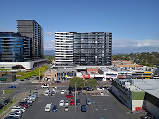
The City of Stonnington is currently in the process of creating a masterplan for their Chapel Street Transformation Project. Their ambitious goal is “to transform Chapel Street into one of the great streets of the world.” This project is heavily supported by cycling lobbying groups who are wanting to see on-street parking removed from Chapel Street in order to create safe cycling passageways. It is possible that the council may head in that direction. Such an outcome is feasible since there have been many cyclist injuries and even some deaths on this very popular cycling corridor that runs from Princess Hwy all the way to the Yarra River, along Chapel Street.  A possible outcome will be to remove all on-street parking on Chapel Street from Greville Street, Prahran all the way to Toorak Road, South Yarra. This would take out a very large chunk of convenient car parking spaces from this large retail, dining and entertainment precinct.   It seems that Chapel Street needs plentiful parking

My Suggestion Of A Future Peak Hour Express Bus From Box Hill To The CBD

Image
The Box Hill Metropolitan Activity Centre 2036 Draft Master Plan states: “The resident population of BHMAC has grown by 3% per annum from 3,800 people in 2006 to 5,100 in 2016…. The resident population is anticipated to grow to between 12,700 and 14,000 people by 2036, requiring between 4,000 and 4600 additional dwellings. The majority of new housing in the BHMAC is anticipated to be in medium and high rise apartments and mixed use development.”  This means that the Box Hill activity centre will see huge growth in the next decade or so with the population set to become more than double what it was in 2016. Much of that growth has already occurred. One can see that the skyline has changed dramatically since 2016 with residential skyscrapers repeatedly popping up. The latest approval is for a fifty one story residential tower which will be part of the redevelopment of Box Hill Central.  Such residential growth will put huge pressure on Melbourne’s busiest train line - the Lilydale/Belgra

My Dream For The Future Of Glen Waverley And Brandon Park

Image
Glen Waverley is a major activity centre that is moving along nicely with development. It will have two train stations in the future, thanks to the Suburban Rail Loop (SRL) or orbital train line passing through it. It is gifted for future urbanisation. My dream idea is to bring the Glen Waverley train line underground just after Syndal station and extend the line to Brandon Park which is another major activity centre. Glen Waverley and Brandon Park would be urbanised in the process. I know that I wrote a post saying that I believe that the Glen Waverley line shouldn’t be extended to Knox City but instead have a fast bus running between Glen Waverley and Knox City. Why then choose Brandon Park for my idea instead of the proposed line extension to Knox City.   Brandon Park is only 3km from Glen Waverley whereas Knox City is double that distance. Therefore, there will be half the tunnelling to be done. Also, the proposed train line extension to Knox City will have two new stations (one ne

Extension Of The Glen Waverley Line To Knox City vs Upgrading Local Bus Route To A Fast Bus

In their 2020-2050 Melbourne Rail Plan, the Rail Futures Institute proposed an underground extension of the Glen Waverley line to Knox City in Wantirna South to be delivered by 2040. Here are the details of their report: “The Glen Waverley line has currently significant unused capacity. By 2040, it is proposed that the Wallan/Upfield – Glen Waverley corridor will be extended a further 6 km in Melbourne’s east from Glen Waverley to Knox City, resulting in a 75 km overall corridor from Wallan to Knox City serving at least 36 stations. The Knox City extension will provide two sections of underground twin tunnel totalling 5 km to extend the line from Glen Waverley to Knox City. It will provide new underground platforms at Glen Waverley, a new intermediate station, major “park and ride” facility, bus interchange and train stabling sidings on the surface at Wantirna South, and a new underground terminal station at Knox City Major Activity Centre. The new stations at Wantirna South and Knox C

My Suggested Footscray To Frankston Arterial

Footscray and Frankston are two of the six Central Activities Districts in Melbourne’s master plan for future growth. These districts are the largest of activity centres outside of the CBD. Another of the six is Dandenong.  In this post I am suggesting a series of motorways and major arterial roads, some already existing, that will connect these three activity centres in a direct south-east/south-west route.  This system of roads will also connect with other major motorways, such as the West Gate Freeway to form a variety of alternative routes that could take you from one extreme end of suburbia to the other - taking pressure off major motorways such as the Monash Freeway which sees extreme levels of congestion at times.  For example, on this suggested series of motorways and arterial roads, one could drive from Rosebud to Melton which would be a trip of 110 km’s of continuous motorways and arterial roads without using the Eastlink or the Monash Freeway. Tolls paid would be approximate

My Suggestion Of A Bus Interchange And Park & Ride At The End Of The Eastern Freeway

In one of my recent posts, I alluded to one way to alleviate the problem of the Mumbai style bottleneck at the end of the Eastern Freeway is by building a “North-South Link” between The Eastern and the Monash Freeways (even though the purpose of my suggestion was to ease congestion that will be created by the North-East Link on inner eastern suburbs roads).   The East-West Link that will surely eventually be built will no doubt help this bottleneck slightly by creating a free-flowing motorway. But how, for example, would the East-West Link alleviate the rat-running that takes place through the streets of Collingwood and surrounds during peak hour? Additionally, the East-West Link will be a Tollway which would still encourage drivers to exit at Hoddle Street.  Suburban sprawl was designed primarily for cars. Before suburbia there were no motor vehicles. Therefore, in a large span of suburbia like Melbourne, people will always drive, as they do in all Australian and American cities. A on

My Suggestion Of Zoning Changes To Create Three Tiers Of Buildings Facing Albert Park Lake

Image
    Melbourne has a few things in common with Vancouver and Chicago. It has a large amount of waterfront close to the city centre thanks to its large bay. It is viewed as an attractive city and hence has had high population growth over the years. Chicago's population has shot up at various times and now stands at over eight million people. Melbourne’s population has grown rapidly and currently stands at around 5 million. Vancouver has grown by approximately 1.4 million residents since 1980 to around 2.6 million people today, almost double the population of that time. All three cities have universities that are ranked among the world’s top 50, hence, they attract talent. Over the years, Vancouver and Melbourne seem to alternate on their number one positions on The Economist’s rankings of the world’s most liveable cities and always seem to be in the top 10. Chicago often ranks among the top 50 ahead of cities like New York. All three cities are not afraid of heights and hence they bu

My Suggestion Of A Docklands Super Car Park Connected To A CBD Elevated Walkway

The Western Distributor Project (currently under construction) - which will create an alternative and faster link between the West Gate Freeway and the CBD has the potential to dump a large number of vehicles onto Wurundjeri Way between the Marvel Stadium and the Southern Cross train station. To alleviate such traffic congestion and to take a large number of cars off city streets, I suggest a supersized car park facility to be built with its entrances on Wurundjeri Way right next to the Marvel Stadium. This facility would take many cars off the road heading into the CBD during the weekday mornings. But where could it be built? Perhaps we could learn a lesson from Manhattan’s Hudson Yards, the largest mixed-use private real estate venture in American history, built directly on top of a railyard. It is currently under construction and will soon be completed. The tallest of its sky-scrapers is 395 meters high, significantly taller than Melbourne’s impressive sky-scrapers. Hence, I sug

My Suggestion Of A North-South Motorway Link In Melbourne

Melbourne’s North-East Link (currently under construction) will take thousands of cars and trucks off local roads in the north-eastern suburb's per day (such as the infamous Rosanna Rd which often looks like a truck car park). But not all vehicles will be using this tollway to access the East Link tollway (as designed) and vice versa. Hence, the North-East Link will significantly increase traffic on local roads in the inner-eastern and eastern-suburbs, on top of increasing traffic on Hoddle St, close to the CBD. The more expensive, route option C (through Templestowe) would have been the best option for this link. It would have served the purpose of this motorway nicely, by sending freight vehicles across from areas like Dandenong to the Metropolitan Ring Road as well as onto the Hume Highway.   But perhaps the cheaper route that was chosen by the North East Link Authority - which runs directly south through Bulleen - has opened up other opportunities to better Melbourne's mo

My Suggestion Of A Melbourne City Bicycle Park And Ride

  With the Melbourne Metro Tunnel Project’s plans for Anzac Station to have three main entrances (One on the Shrine of Remembrance Reserve, another at the Albert Road Reserve and the other at the train/tram interchange on St Kilda Road) there is a real opportunity to do something special here for cyclists who commute to the city. How? I’m sure many cyclists commuting into the CBD find their ride to be enjoyable along the way but quite treacherous as soon as they enter the CBD. Well, here is a possible solution to that cycling stress.  A City Bicycle Park & Ride. There is a small car park in the median strip on Albert Rd between Albert Rd Reserve and Kings Way, right next to the future Anzac Station. I’m guessing its council land owned by the City of Port Phillip. What if the land was developed for the purpose of being a bicycle park & ride? Cyclists would park their bikes there during their morning commute to work and jump onto a train or tram for the final part of their journe